
MetOcean Viewer
4.5.1Extract and plot live data from NOAA and USGS stations, view hydrodynamic model data saved to various formats, generate maps, charts and more, with this powerful, open-source application
Scientific agencies like NOAA and USGS provide the public with freely accessible data from numerous research stations across the United States. This information can be very helpful, provided you have an easy way to download, interpret and plot it.
MetOcean Viewer is a versatile application that can extract and plot live data from NOAA and USGS stations, create tide predictions using XTide, view hydrodynamic modeling files, plot high water marks and generate charts and maps that can be exported.
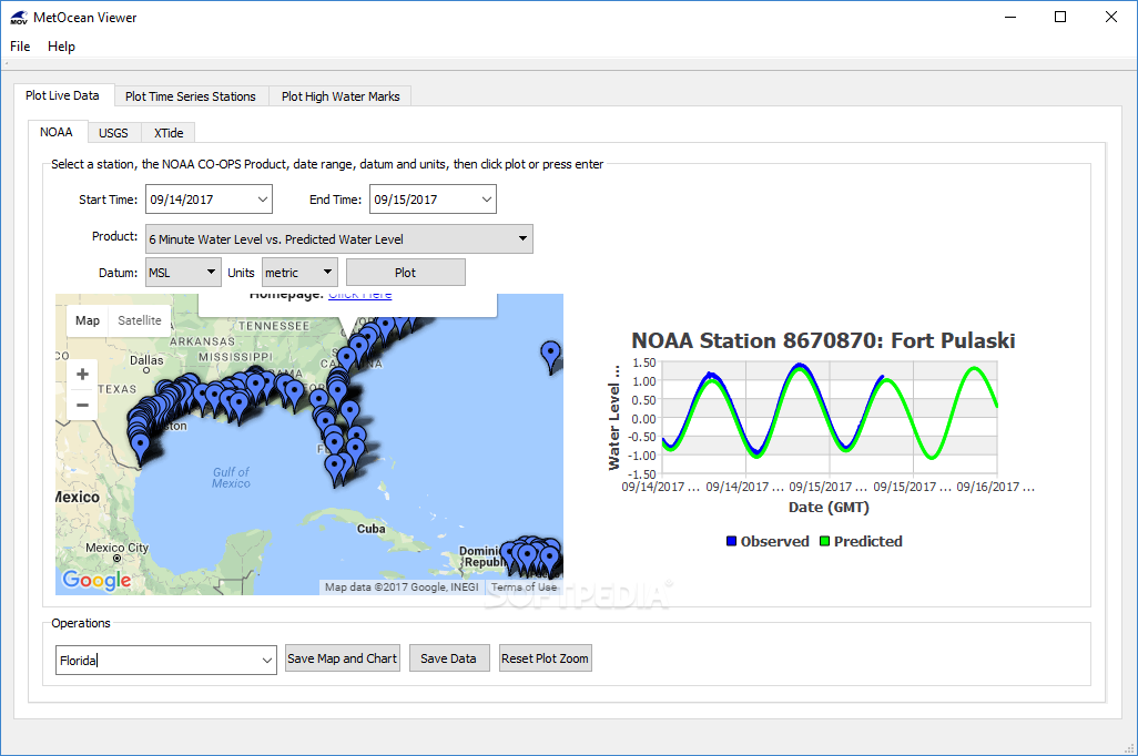
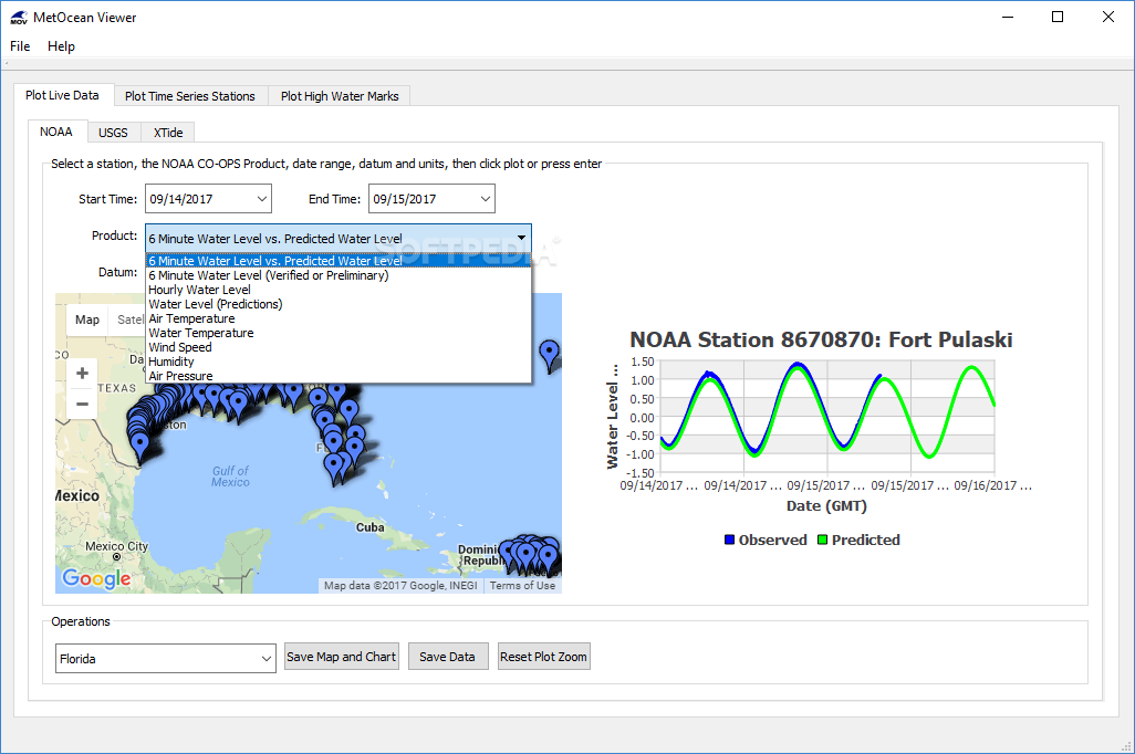
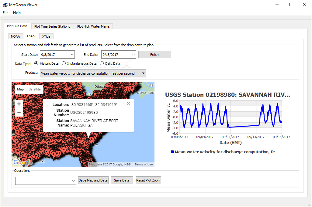
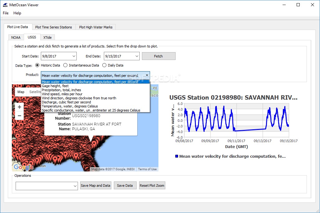
The application allows you to select any station in the United States and gather various types of data; this includes water level, air temperature, water temperature, wind speed, humidity, discharge, gage height and so on.
After this data has been downloaded, the program can generate a graph that highlights the variations of certain parameters for the selected time frame. This chart, along with the map, can be saved locally as an image file.
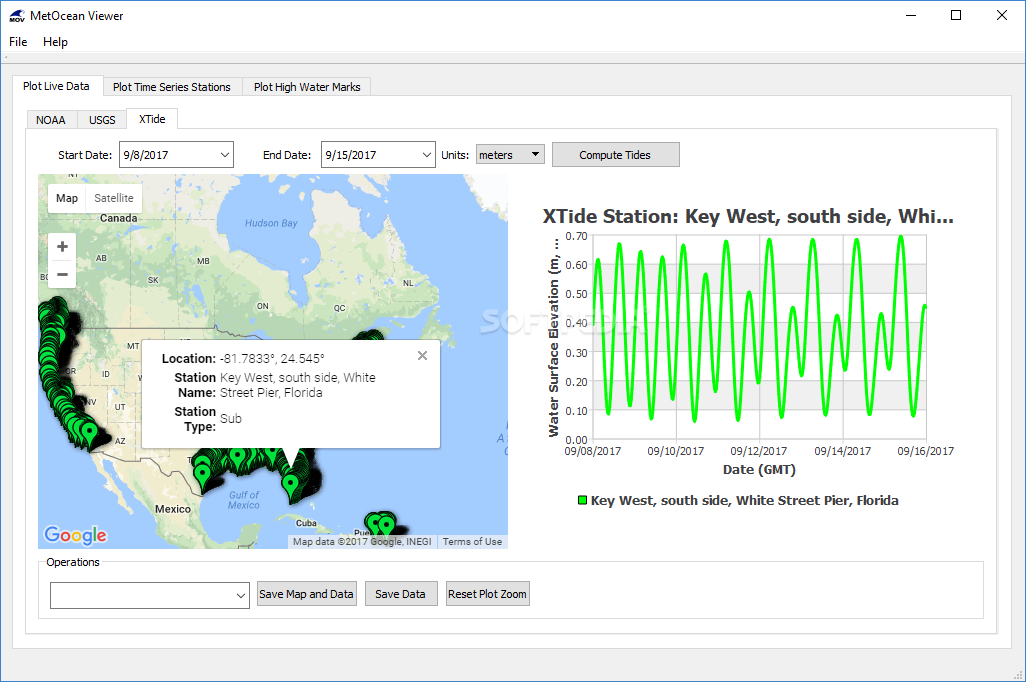
MetOcean Viewer even enables you to create tide predictions using XTide; simply select one of the available stations and set the start and end dates.
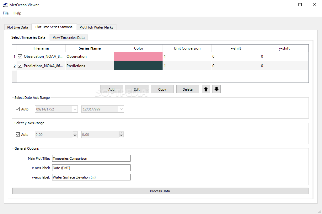
In addition to extracting data, the application is also capable of reading ARCIRD, IMEDS and NetCDF files in order to help you plot and analyze the information. You can load data from multiple sources set the name and color of each series.
Once the data has been processed, the program generates a graph, which can be exported together with a map of the stations.
If you provide MetOcean Viewer with a file that contains high water mark data, it can help you create maps and scatter plots that make it much easier to interpret the information, and these graphic representations can, of course, be exported.
Overall, MetOcean Viewer is an incredibly useful application that can aid you with gathering, reading and plotting hydrological data. It is easy enough to use and offers an impressive feature set, but it would have been even better if some documentation were provided to help out less-experienced users.
MetOcean Viewer is a versatile application that can extract and plot live data from NOAA and USGS stations, create tide predictions using XTide, view hydrodynamic modeling files, plot high water marks and generate charts and maps that can be exported.
Plot data from NOAA and USGS stations across the US
The application allows you to select any station in the United States and gather various types of data; this includes water level, air temperature, water temperature, wind speed, humidity, discharge, gage height and so on.
After this data has been downloaded, the program can generate a graph that highlights the variations of certain parameters for the selected time frame. This chart, along with the map, can be saved locally as an image file.
MetOcean Viewer even enables you to create tide predictions using XTide; simply select one of the available stations and set the start and end dates.
View hydrodynamic model data saved in various formats
In addition to extracting data, the application is also capable of reading ARCIRD, IMEDS and NetCDF files in order to help you plot and analyze the information. You can load data from multiple sources set the name and color of each series.
Once the data has been processed, the program generates a graph, which can be exported together with a map of the stations.
Compare high water marks, create maps and generate scatter plots
If you provide MetOcean Viewer with a file that contains high water mark data, it can help you create maps and scatter plots that make it much easier to interpret the information, and these graphic representations can, of course, be exported.
Overall, MetOcean Viewer is an incredibly useful application that can aid you with gathering, reading and plotting hydrological data. It is easy enough to use and offers an impressive feature set, but it would have been even better if some documentation were provided to help out less-experienced users.
51.5 MB
Info
Update Date
Jul 30 2021
Version
4.5.1
License
GPLv3
Created By
Zach Cobell
Related software CAD


