
Sanchez
1.0.19Enhance satellite imagery and manipulate atmospheric data with ease, using this CLI-based software that offers a diverse collection processing operations
Geostationary satellites and their imagery products offer a great deal of insight, especially when the said image products are being handled, processed and analyzed accordingly. The pool of software that specializes in such areas of expertise is quite abundant, but most apps that target such tasks often carry an inherent complexity.
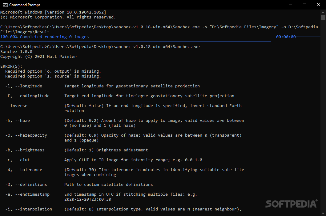
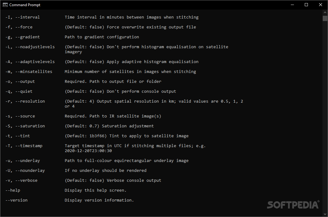
Designed in order to tackle the image processing required when dealing with satellite images that need corrections, adjustments, as well as actual analysis through processing, Sanchez will provide users with a CLI-based approach, which relies on pre-defined commands and arguments for various tasks.
Users will be able to either add individual files, as well as entire directories, and the CLI allows them to indicate that directly, without the need for any special arguments. Speaking of arguments, an array of pre-defined commands are available at users’ disposal, which can be prompted when running the app for the first time.
The developer was kind enough to provide a detailed usage tutorial, here, which users can consult for their various imagery. Aside from the geostationary data re-compositions which can be performed using Sanchez, if required, users will also be able to re-project their data, especially if working with equirectangular projections.
47.2 MB
Info
Update Date
Aug 11 2021
Version
1.0.19
License
Apache License 2.0
Created By
Matt Painter
Related software CAD


